
DIVINE ECSTASY
ഹിമവാന്റെ മടിത്തട്ടിലൂടെ യുള്ള എന്റെ യാത്രകള് അവയുടെ ചിത്രങ്ങള് കുറിപ്പുകള് എന്നിവയാണ് ഇതില് ഉള്പെടുത്തിയിട്ടുള്ളത്. കാശ്മീര് മുതല് അരുണാചല് വരെയുള്ള യാത്രകളും ചിത്രങ്ങളും ആണ് Himalaya the top of the world ഇല് ഉള്പെടുത്തണം എന്ന് വിചാരിക്കുന്നത് നന്ദി.

യാത്ര യുടെ തുടക്കം റിഷികേശില് നിന്ന്.

Rishikesh ऋषिकेश is a city and a municipal board in Dehradun district in the Indian state of Uttarakhand


ആദ്യ രാത്രിയിലെ ഗംഗയുടെ തീര കാഴ്ച എന്നോടൊപ്പം പ്രഫുല്, ആനന്ദ്.
Rishikesh ऋषिकेश is a city and a municipal board in Dehradun district in the Indian state of Uttarakhand

അതിരാവിലെ ചെറിയൊരു മഴയോട് കൂടി ഗംഗനദിതടകാഴ്ചകള്ക്ക് തുടക്കമായി
Rishikesh Morning


കുറച്ച് സമയങ്ങള്ക്കുശേഷം കണ്ട ഗംഗനദി


 കാഴ്ചകള്
Holy city - located in the foothills of the Himalaya in northern India. Uttarakhand


 Evening prayers and Arrati at Har ki Pauri, Haridwar

Indiaroad Delhi 203Km(NH58) Haridwar
 വഴിയോരകാഴ്ചകള്


to Uttarkashi


പുറം കാഴ്ചകള്


 വീണ്ടുമൊരു തടസം കൂടി
ഞങ്ങള്ക്ക് മുന്പ് കടന്നുപോയ ലോറി ഒപ്പിച്ച പണിയാണ് എതിരെവന്ന വാഹനത്തിനു സൈഡ് കൊടുത്ത് മണ്ണില് ടയറുകള് പൂണ്ടു കിടപ്പായി.മറു ഭാഗം ഇടിഞ്ഞു പോയതിനാല് വാഹനങ്ങള്ക്ക് കടന്നു പോകാന് കഴിയാതെയുംമായി.
വീണ്ടുമൊരു തടസം കൂടി
ഞങ്ങള്ക്ക് മുന്പ് കടന്നുപോയ ലോറി ഒപ്പിച്ച പണിയാണ് എതിരെവന്ന വാഹനത്തിനു സൈഡ് കൊടുത്ത് മണ്ണില് ടയറുകള് പൂണ്ടു കിടപ്പായി.മറു ഭാഗം ഇടിഞ്ഞു പോയതിനാല് വാഹനങ്ങള്ക്ക് കടന്നു പോകാന് കഴിയാതെയുംമായി.
എറെ പണിപെട്ട് ലോറി മാറ്റി യാത്രതുടര്ന്നു...


Maneri Dam is a concrete gravity dam on the Bhagirathi River located at Maneri, east of Uttarkashi. The primary purpose of the dam is to divert water into a tunnel which feeds the 90 MW run-of-the-river Tiloth Power Plant.Maneri Dam is a 39 m (128 ft) tall and 127 m (417 ft) wide

Indiaroad Delhi 203Km(NH58) Haridwar 171Km(NH58 , NH94 , NH108) Uttarkashi 14 Km (NH 108) Maneri Dam - 388Km


Indiaroad Delhi 203Km(NH58) Haridwar 171Km(NH58 , NH94 , NH108) Uttarkashi 14 Km (NH 108) Maneri Dam 65.4Km(NH 108) Gangotri - 453Km II


 old home Dhalri
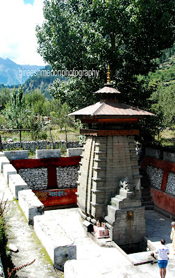 Temple - Dhalri

 apple farm


Kedarnath is named in honor of King Kedar who ruled in the Satya Yuga. He had a daughter named Vrinda who was a partial incarnation of Goddess Lakshmi. She performed austerities for 60000 years. In honour of her, the land is named Vrindavan. However, Kedarnath and its temple exist from the Mahabharata Era when the Pandavas are supposed to have pleased Lord Shiva by doing penance there.


There are 2 ways to reach Kedarnath:


 Delhi (NH24,NH58) 476Km joshimath

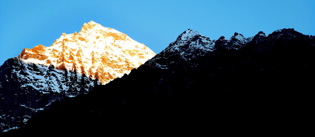
മലമുകളിലെ മലവെള്ളപാച്ചിലുമായ് ഗംഗ

രാംജുലയും ലക്ഷ്മണ് ജുലയും
Ram Jhula and Lakshman Jhula - Rishikesh City

Holy city - located in the foothills of the Himalaya in northern India. Uttarakhand

Lakshman Jhula is an iron suspension bridge situated in Rishikesh in Indian state of Uttarakhand . It is made over river Ganges to cross the river and is a landmark of Rishikesh.
It is said that Lakshman crossed Ganges on jute ropes between the place where this bridge is built. Lakshman Jhula was built in 1939. There are spectacular views from the bridge.


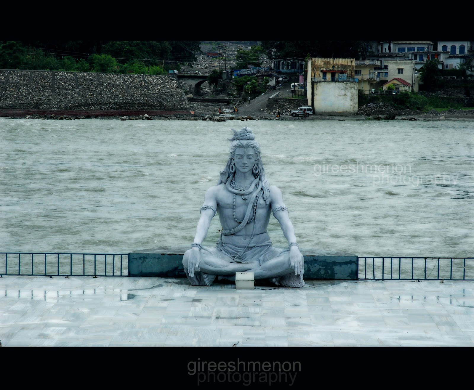
ഗംഗനദിക്കരയിലെ ശിവപ്രതിമ
Shiva Statue On Ganga River Bank Rishikesh

me
Indiaroad Delhi 203Km(NH58) Haridwar 19.5Km (NH58) Rishikesh - 222.5Km
Gateway to Lord Vishnu

Clock Tower on the Malviya Dwipa at Har-ki-Pauri.Haridwar

Aerial view of Haridwar
 Evening prayers and Arrati at Har ki Pauri, Haridwar
 വഴിയോരകാഴ്ചകള്

ഉത്തര കാശിക്കുള്ള വഴിമധ്യേ നിനച്ചിരിക്കാതെ മഴ കനത്തുതുടങ്ങി .ഉരുള്പൊട്ടലിലും മലവെള്ള പാച്ചിലിലും ഹിമാലയന് റോഡുകള് ഒലിച്ചുപോയി മുന്പോട്ട്ഉള്ള യാത്ര അപകടകരമായ സാഹചര്യത്തില് യാത്രക്ക് താല്കാലിക വിരാമം.


മഴ ഒഴിഞ്ഞുനിന്ന ഒരു ദിവസം കാഴ്ചകള്ക്കായ് താമസ സ്ഥലത്തിന് ചുറ്റുമുള്ള പൈന് കാട്ടിലൂടെ - കൂടെ ആനന്ദ് ,മനോജ്


രണ്ടു ദിവസത്തെ വിശ്രമത്തിന് ശേഷം തെളിഞ്ഞ അന്തരീക്ഷത്തില് യാത്ര തുടര്ന്നു.
CHIR PINE FOREST The Himalayan Subtropical Pine Forests are the largest in the Indo-Pacific region. They stretch throughout most of the 3,000-kilometer length of this the world's youngest and highest mountain range. Some scientists believe that climate change and human disturbance are causing the lower-elevation oak forests to be gradually degraded and invaded by the drought-resistant Chir pine (Pinus roxburghii), the dominant species in these subtropical pine forests. Biologically, the ecoregion does not harbor exceptionally high levels of species richness or endemism, but it is a distinct facet of the region's biodiversity that should be represented in a comprehensive conservation portfolio.
to Uttarkashi

ഇന്നലെ തോരാതെ പെയ്ത മഴയുടെ തിരുശേഷിപ്പുകള് റോഡിനിരുവശവും കാഴ്ചകള് തീര്ത്ത്. പാത കണ്ടെത്തുകയും പണിയുകയും ചെയ്യുന്ന യന്ത്രങ്ങള്ക്കു നടുവിലൂടെ ...


Himalaya the top of the world


Uttarkashi (Kashi of the north) is situated on the banks of river Bhagirathi (ganga) at an altitude of 1352 M above sea level.

ഉത്തര കാശി യില് ഗംഗ ഭാഗീരഥി യാണ് ഉഗ്രരൂപിയുമാണ്. ഇവിടെ പുണ്യം തേടി എത്തുന്നവരുടെ മുന്നിലേക്ക് ഗംഗയും (ഗോമുഖ്) യമുനയും (യമുനോത്രി) ഒഴുകിയെത്തുന്ന കാഴ്ച മനോഹരമാണ്.


It is the land of Uttarkashi district that gives rise to two great and reverent rivers of India the Bhagirathi, called the Ganga in the plains and the Yamuna. The Ganga coming up in the glaciers `gaumukh' traverses 128 kms. in Uttarkashi district before flowing down farther. The third important river of this district is Tons besides host of tributaries that drain these areas.
Nehru Institute of Mountaineering (NIM): NIM is one of the few mountaineering institutes in India. It conducts various mountaineering and climbing training courses and besides organising climbing expeditions
Indiaroad Delhi 203Km(NH58) Haridwar 171Km(NH58 , NH94 , NH108) Uttarkashi - 374Km
Indiaroad Delhi 203Km(NH58) Haridwar 171Km(NH58 , NH94 , NH108) Uttarkashi - 374Km
 വീണ്ടുമൊരു തടസം കൂടി
എറെ പണിപെട്ട് ലോറി മാറ്റി യാത്രതുടര്ന്നു...


Maneri Dam


The power station is stage one of the Maneri Bhali Hydroelectric Project which was planned in the 1960s. It was completed and commissioned in 1984. Dharasu Power Station, the second stage, was halted in 1990 due to funding issues and was not restarted until 2002. It was eventually completed and commissioned by 2008
Indiaroad Delhi 203Km(NH58) Haridwar 171Km(NH58 , NH94 , NH108) Uttarkashi 14 Km (NH 108) Maneri Dam - 388Km

വഴി മദ്ധ്യേ മലയിടിഞ്ഞ് വീണ് റോഡ് തകര്ന്നു, പാറകള് മാറ്റി റോഡ് പുനര്നിര്മിക്കാന് യെന്ത്രങ്ങള് പണി തുടങ്ങി...

കട്ടി കുറഞ്ഞ പാറകള് അടങ്ങിയ മലനിരകള് ആയതിനാല് മലയിടിച്ചില് ഇവിടെ സാധാരണമാണ്. ഇതിലൂടെ കടന്നു പോകുന്ന വാഹനങ്ങളില് പാറകള് വീണുള്ള അപകടങ്ങള് ഇവിടെ പതിവാണ്.

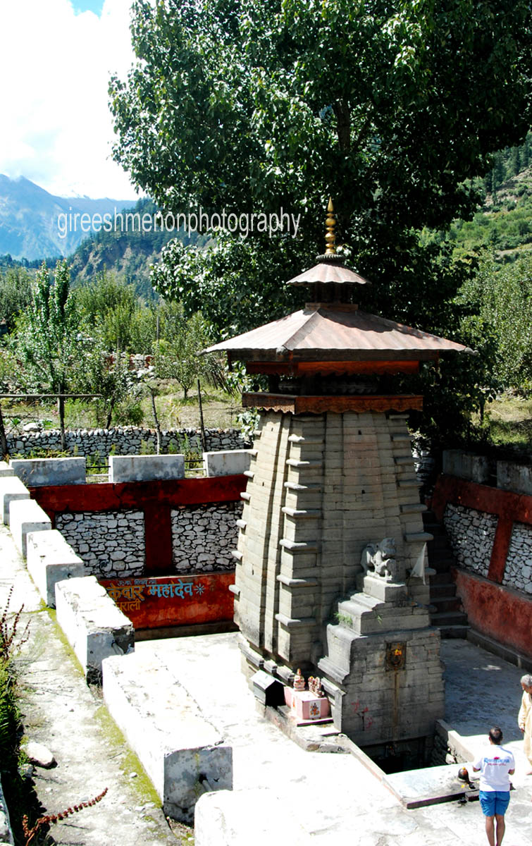
Pilot Baba Ashram - Bhatwari

ഗംഗോത്രി യിലേക്ക് അടുക്കും തോറും ഇരുളിന്റെ ഒപ്പം തണുപ്പും കൂടി കൂടി വന്നു..
അടുത്ത പ്രഭാതം കണികണ്ടുണരാന് പുതപ്പിനുള്ളില് ചുരുണ്ട് ..

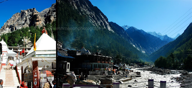
Gangotri

ഗഗോത്രിയില് കാണുന്ന ഈമല യില് നിന്നാണ് (ഗോമുഖ് ) ഗംഗ നദിയുടെ ഉത്ഭവം ഇവിടെ നിന്ന് ഉത്ഭവിച്ചു 2510 km സഞ്ചരിച്ച് ഇന്ത്യയിലെ ഏറ്റവുംവലിയ നദി ആയ ഗംഗ ബംഗാള് ഉള്കടലില് ചെന്ന് ചേരുന്നു (ഗോമുഖ് ഇല് നിന്ന് താഴെ ബംഗാള് ഉള്കടല് വരെ ഗംഗക്കൊപ്പം യാത്രചെയ്യുവാന് ഇവിടെ നില്ക്കുമ്പോള് ഒരാഗ്രഹം കൂടി )
Gangotri It is situated at the bank of river Bhagirathi(ganga) located
at a height of 3042 meters from the sea level


Gangotri is the
origin of River Ganga and one of the four sites in the Chardham Yatra. Here Ganga is known as Bhagirathi, named after the ancient king Bhagirath, who
performed penance to bring her down from the heavens. It is believed that
bathing in her waters brings deliverance from sins committed in the present and
past births.

Gangotri Temple


DEVADARU

A moderate to large sized evergreen coniferous tree grows up
to 80 meters in height. Leaves needle like, sharp, pointed, triquetrous, male
cones solitary, cylindrical, found at the tip of barnchlets, females globose,
formed of woody placenta scales. Seeds pale brown, with longer wings aid in
dispersion. Heartwood is yellowish brown, fragrant and yield oil on heating.
MEDICINAL PROPERTIES
Plant pacifies vitiated vata, kapha, pain, arthritis, ear
ache, inflammation, headache, epilepsy, insomnia, cough, bronchitis, hiccough,
diabetes, urinary tract infections, calculi, skin diseases and cardiac
disorders. Useful part :
Leaves, Heartwood, Oil.
Distribution – Growing naturally in Himalayan
valley also found in Ooty district of Tamilnadu.


Lanka
Chatti, Asia’s highest bridge at an elevation of 2789 meters of Sea level over
the river Ganga.


Dhalri village Harsil


 apple farm
Gangotri (NH108)19.9Km Harsil

പോകുന്ന വഴിയില് കണ്ടൊരു പട്ടാള ക്യാമ്പ്
ഗംഗോത്രിയോട് താല്കാലിക വിടവാങ്ങല് വീണ്ടും കണ്ടുമുട്ടും വരെ.

യാത്രയില് കണ്ട ഹിമാലയന് താഴ്വരയിലെ ഒരു ഗ്രാമവും,ഗ്രാമീണനും


Tehri Dam is a
multi-purpose rock and earth-fill embankment dam on the Bhagirathi River near
Tehri

രാജ്യത്തെ എറ്റവും പൊക്കം കൂടിയ അണകെട്ട് - 1961 ഇല് ആലോചന തുടങ്ങി 1978 ഇല് പണിതുടങ്ങിയ അണകെട്ട് 2016 ഇല് പൂര്ണ്ണമായ് പ്രവര്ത്തനം തുടങ്ങുമെന്ന് പറയപെടുന്നു.

Tehri It is the
primary dam of the Tehri Hydro Development Corporation Ltd. and the Tehri
hydroelectric complex. Phase 1 was completed in 2006, the Tehri Dam withholds a
reservoir for irrigation, municipal water supply and the generation of 1,000 MW
of hydroelectricity. Two more phases with an additional 400 MW run-of-the-river
and 1,000 MW pumped storage hydroelectricity are under construction
Indiaroad Delhi 203Km(NH58) Haridwar 171Km(NH58 , NH94 , NH108) Uttarkashi 14 Km (NH 108) Maneri Dam 65.4Km(NH 108) Gangotri - (453Km) II
Gangotri (NH108)19.9Km Harsil (NH108,NH94)138Km Tehri Dam Reservoir - 157Km (610Km)
K e d a r n a t h

6940 m / 22769 ft
Kedarnath - are two mountains in the Gangotri Group of peaks
in the western Garhwal

Kedarnath, It is a nagar panchayat in Rudraprayag district. The most remote of the Char Dham sites, located in the Himalayas, about 3584m(11,657 feet) above sea level near the head of river Mandakini.


Kedarnath Shiva Temple

In his last days,
Adi Shankara travelled to the Himalayan area of Kedarnath-Badrinath and
attained videha mukti ("freedom from embodiment"). There is a samadhi
mandir dedicated to Adi Shankara behind the Kedarnath temple.

........River Mandakini

There are 2 ways to reach Kedarnath:
1) By foot for a steep 14 km trek through a paved path (horses or palanquins are available for rent) from Gaurikund, which is connected by road from Rishikesh, Haridwar, Dehradun and other known hill stations of Garhwal and Kumaon regions in Uttarakhand
2) through helicopter service.

Indiaroad Delhi 203Km(NH58) Haridwar 171Km(NH58 , NH94 , NH108) Uttarkashi 14 Km (NH 108) Maneri Dam 65.4Km(NH 108) Gangotri - (453Km) II
Gangotri (NH108)19.9Km Harsil (NH108,NH94)138Km Tehri Dam Reservoir (NH109)
169km Kedarnath - 326Km (to Delhi 936Km)
B a d r i n a t h


ജോഷിമഠം - ത്തില്നിന്നു ബദ്രിനാദ് - ലേക്കുള്ള വഴി വളരെ ഇടുങ്ങിയതും ആഴത്തിലുള്ള കൊക്കകള്ക്കരികിലൂടെയുമാണ് ഇതിനാല് ഇവിടെ വാഹനാ പകടങ്ങളും കൂടുതല് ആണ് യാത്രയില് കണ്ട ഒന്നും അവശേഷിക്കാത്ത ഒരുകാഴ്ച


ഇടവേള ..

Badrinath is a nagar
panchayat in Chamoli district in the state of Uttarakhand. (3,415 metres -11,204
feet) It is in the Garhwal hills,on the banks of the Alaknanda River.


Badrinath vishnu Temple

Neelakand peaks

hot spring

Mana village
Trekking from
Badrinath to Mana village, 3 kms
Mana village is a
quaint tiny hamlet situated on the Indo-Tibetan border. This village is the
last village of India and it is now declared as a tourism village of
Uttarakhand.

The residents of
Mana village are the last generation of Bhotia community of Mongolian tribes.
When the Badrinath temple opens after Akshaya Tritaya in May, they come and
live here for 6 months to keep the culture and traditions of their tribe alive.
The rest of the year they live in Chamouli, which is 100 Km away from
Badrinath. The total population of this village is 200.


മനുഷ്യനെ ചുമക്കുന്ന മനുഷ്യന് - മനാഗ്രാമത്തില്നിന്നുള്ളകാഴ്ച

Veda Vyas cave : it
is 5111 years old cave
This
is where Veda Vyas resided and composed the whole of Mahabharat to Ganesha.

The last Tea-stall
at the Indo-Tibet Border, Mana village

View of Nar and Narayan Peaks


Origin of Saraswati
River, near mana village. this is said be origin of Saraswati river coming out
and going underground again as this river is not visible anywhere from source
upto Allahabad Sangam in UP where it is said to merge into Ganga river along
with Yamuna river.Very close to visible river Saraswati there is very small
water stream said to be water from Mansarover Lake in China.

kesava prayag
joining point of
river alakananda and saraswathy at Bhim Pul Mana village

Bhim Pul
This is a
massive rock that forms a bridge near the fountain of Saraswati river.
Legend
has it that when Pandavas were crossing the river, Draupadi found it difficult
to follow. Bhim lifted a huge rock and placed it over to form a natural bridge.

alakananda river

the way of
mahaprasthana


ഇടവേള ..
Kedarnath (NH109,NH58)162 km joshimath (NH 58) 43.6Km Badrinath 3Km Mana village
Indiaroad Delhi 203Km(NH58) Haridwar 171Km(NH58 , NH94 , NH108) Uttarkashi 14 Km (NH 108) Maneri Dam 65.4Km(NH 108) Gangotri - (453Km) IIGangotri (NH108)19.9Km Harsil (NH108,NH94)138Km Tehri Dam Reservoir (NH109)169km Kedarnath II Kedarnath (NH109,NH58)162 km joshimath (NH 58) 43.6Km Badrinath 3Km Mana village - 534KmII (to Delhi 1470Km)