Arunachal
Pradesh is a state of
India, located in the far northeast. It borders the states of Assam and
Nagaland to the south, and shares international borders with Burma in the east,
Bhutan in the west, and the China in the north. The Chinese consider Arunachal
Pradesh as a part of China, called "South Tibet", but it is actually
in India. The northern border of Arunachal Pradesh reflects the McMahon Line, a
controversial 1914 treaty between the United Kingdom and Tibet, which was never
accepted by the Chinese government, and not enforced by the Indian government
until 1950.
Arunachal also known
as "land of the rising sun''. Like other parts of Northeast India, a
majority of the people native to the state are of Tibeto-Burman origin. A large
and increasing number of migrants have reached Arunachal Pradesh from many
other parts of India. Part of the famous Ledo Burma Road, which was a lifeline
to China during World War II, passes through the eastern part of the state.
അരുണാചല് പ്രദേശ് - ഇന്ത്യയില് ഇന്ത്യക്കാരന് അനുമതി ഇല്ലാതെ Innerline Permit (ILP)* പ്രവേശനം അനുവദിക്കാത്ത ഒരു സ്റ്റേറ്റ്
നൂറു ശതമാനവും ആദിവാസികള്, പരിഷ്കാരികള്, ഭൂരിഭാഗവും ക്രിസ്ത്യന് അനുയായികള് എങ്കിലും പാരമ്പര്യത്തെ കാത്തു സൂക്ഷിക്കുന്നു ഇന്നും.
എന്തിനെയും ഏതിനെയും പിടിച്ചുതിന്നാന് ഇവര്ക്ക് മടിയില്ല ഇതു കൊണ്ടാവാം ഇവിടുത്തെ മനോഹരമായ പ്രകൃതിയില് ഒരു കിളിയുടെ ചിലക്കല് പോലുംകേള്ക്കാറില്ല
ഇപ്പോഴത്തെ അവസ്ഥയ്ക്ക് മാറ്റങ്ങള് വന്നുതുടങ്ങുന്നു. പ്രകൃതി സ്നേഹികളുടെ നല്ല ഇടപെടലുകള് മരങ്ങളെയും, പക്ഷികളെയും, മൃഗങ്ങളെയും രക്ഷിക്കട്ടെ.

മറ്റുദേശത്തുനിന്നു കുടിയേറി പാര്ത്തവരുടെകുട്ടികള്
ഇവിടുത്തുകാരുടെ ചിത്രങ്ങള് എടുക്കുന്നതിനുമുന്പ് ഇവരുടെ അനുവാദം മേടിക്കുന്നതാണ്നല്ലത് ഇല്ലങ്കില് ചിത്രം എടുത്തതിനു ശേഷം ഇവര് ചോദിക്കുന്ന പണം കൊടുക്കേണ്ടിവരും. ഫെസ്റ്റിവല് സ്ഥലത്ത് ചിത്രങ്ങള് എടുക്കുന്നത് ഫെസ്റ്റിവല് കമ്മറ്റി യുടെ അനുവാദത്തോടു കൂടി മാത്രം.
ഒരിക്കല് പുറത്തുനിന്നു വന്നവരുടെ വണ്ടി തട്ടി ഒരു കോഴി ചത്തു. ഇവര് ഇതിനു നഷ്ട പരിഹാരം കണക്കാക്കിയത് ആ കോഴി മുട്ടയിട്ടു കുഞ്ഞുങ്ങള് ഉണ്ടായി അവയുടെ പലതലമുറകളുടെയും വിലകൂടി കൂട്ടിയാണ് ഇതിവിടെ പറഞ്ഞുകേട്ട കഥയാണ് എന്നാല് ഒരുചിത്രം എടുത്തതിന്റെപേരില് പണത്തിനായി വാളോങ്ങി വെട്ടാന്വന്ന ഒരു അനുഭവം എനിക്കുണ്ടായിട്ടുണ്ട് ഞാന് എടുത്ത ഒരു ചിത്രത്തിന് ചോദിച്ചത് 1000 രൂപയും, അവസാനം അവിടുത്തുകാരായ സുഹൃത്തുക്കളുടെ സഹായത്താല് അന്ന് തടി ഊരു കയായിരുന്നു. പിന്നീട് ഇതുപോലുള്ള നിരവധി അനുഭവങ്ങള് ഞങ്ങള് സുഹൃത്തുക്കള്ക്ക് നേരിടേണ്ടിവന്നിട്ടുണ്ട് . അന്നാട്ടുകാര് മുഴുവന് ഇത്തരക്കാര് എന്നല്ല, ആസമയത്തും, ആ സാഹചര്യത്തിലും അന്ന്അങ്ങനെ ഒരു അനുഭവം ഉണ്ടായി എന്നുമാത്രം.

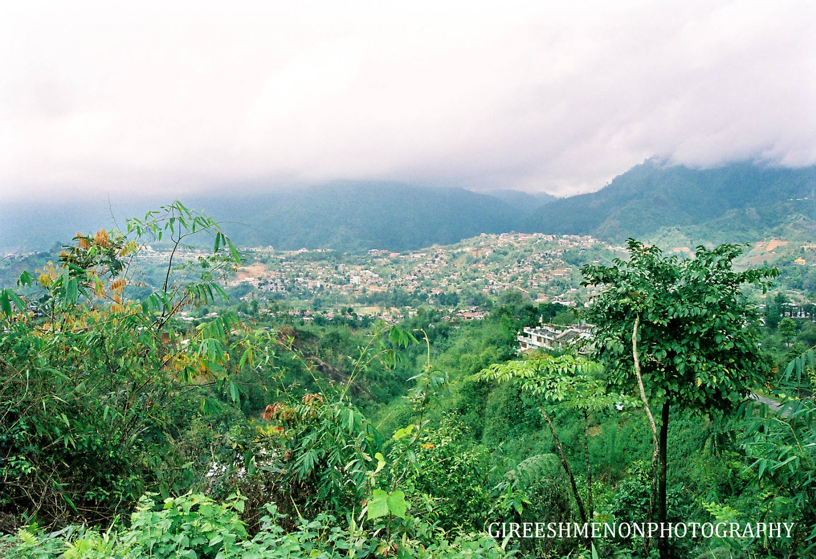
Itanagar is
the capital of the Indian state of Arunachal Pradesh. Itanagar is situated at
the foothills of Himalayas and administratively comes under Papum Pare
district.
Itanagar is well
connected with the rest of the country by road and air communications. There is
a helicopter service between Guwahati and Naharlagun (Itanagar). Buses are
available from Guwahati. The nearest railway station is Harmoti in Assam.
view of Itanagar
town from Itafort
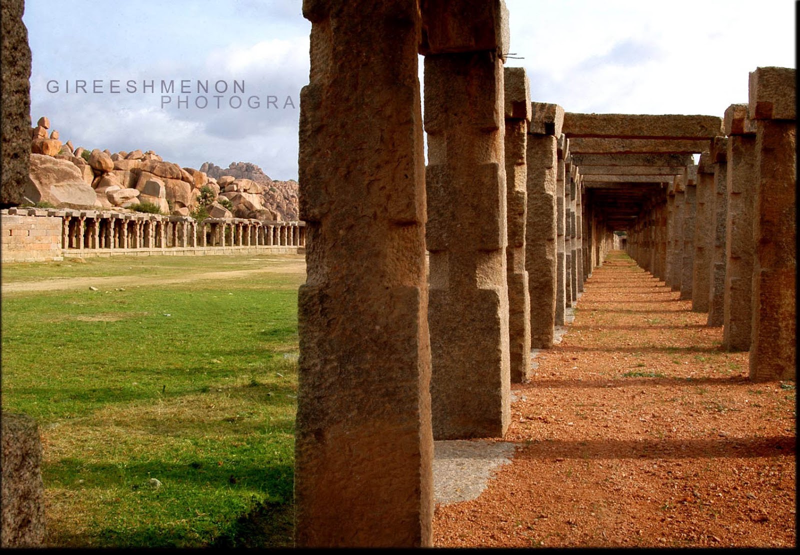
Ita fort is one of the most important historical
sites in the state of Arunachal Pradesh. The name literally means "Fort of
bricks"( brick being called "Ita" in the Ahom language). It was built as early as the 14th or the 15th century.The
fort has an irregular shape, built mainly with bricks dating back to the
14th-15th Century. It has three different entrances at three different
sides, which are western, the eastern and the southern sides.
big tree- Itanagar
ഇറ്റനഗറിലെ ഒരു കൂറ്റന് മരം -
അഞ്ചാറാളുകള്ക്ക് സുഖമായി കഴിയുവാനുള്ളഇടം ഇതിനകത്തുണ്ട്.
Gompa
Buddhist Temple - Consecrated by the Dalai Lama, the Buddhist temple, a beautiful yellow roofed
shrine reflects the extensive Tibetan influence and provides good views of
Itanagar and the surrounding countryside
ക്ഷേത്രത്തിനു പുറത്ത് കണ്ടൊരു ബാലന്,
നല്ല ജീവിത സാഹചര്യങ്ങള്ക്ക് വേണ്ടി പാലായനം ചെയ്യുന്ന ജനതയുടെ പ്രതീകം.
ബിഹാറില്നിന്നും, ഒറീസ്സയില്നിന്നും, ആസ്സാമില്നിന്നും, ബംഗാളില്നിന്നും എല്ലാം, വിവിധ കാരണങ്ങളാല് എത്തുന്നഇവര് ഇവിടെ കണ്ടെത്തുന്ന സാഹചര്യങ്ങള് ക്കനുസരിച്ച് സമ്പന്നരും ദരിദ്രരും ആയിമാറുന്നു. ഇന്ത്യയില് എവിടെയും കാണുന്നതുപോലെതന്നെ ഇവിടെയും. എന്നാല് ലക്ഷകണക്കിനായ മലയാളികള് ഇവിടെയും നല്ലവസ്ത്രത്തിനുള്ളില് സസുഖം വാഴുന്നു.
Chimpu
chang ghar
The original residents of Arunachal Pradesh are a large number of ethnic communities that have thier own heritages, rituals and food habits.The state is rich in traditional foods and beverages. A locally-made drink known as apong [mostly made from millet and rice] is used at all social gatherings and important events.
Preparation
of Apong (millet seed beer)
കോഴിയുടെ കുടല് കൊണ്ട് ഉണ്ടാക്കിയ ചമ്മന്തിയും നാടന് മദ്യവും ഞങ്ങള്ക്കുവേണ്ടി ഉണ്ടാക്കുന്നു.
വയറുനിറയെ മദ്യവും മിഥുന്റെ ഇറച്ചി പാകപെടുത്തിയതും കഴിച്ച് അവിടുത്തെ തണുപ്പില് അടുപ്പിനോട് ചേര്ന്ന് ഉറങ്ങി നേരം വെളുപ്പിക്കുക. ഇതുതന്നെ ആണ് കുറെഏറെജനതയുടെ പ്രധാന ജോലിയും.
pic2004
There are 25 major
tribes in Arunachal. The principal tribes are Adis, Nyishi, Apatani, Tagin,
Mismi, Khampti, Noite, Wancho, Tangsha, Singpho, Monpa, Sherdukpen, and
Aka.These tribes follow their own rituals and customs. The tribal life is very
much associated with major social and cultural events of the state
Nyishi people - the most populous tribe of Arunachal Pradesh
The Nyishis are agriculturalists who practice 'jhuming' , which is a form of shifting cultivation. Rice is the staple food of the people, supplemented by fish, meat of various animals, edible tubers and leafy vegetables. Nyishi, traditionally being dependent on the forest, eat fruits,root, bamboo shoots and fish. Traditional ways of preparing them include steaming, roasting and smoking.


Traditionally,
Nyishi braid their hair and tie it neatly at the forehead with Tibetan thread.
A brass skewer passes horizontally through the tied hair. Cane rings were worn
around the waist, arms and legs. Men wore a cane helmet surmounted with the
beak of the Great Indian Hornbill.The usage of actual Hornbill beaks is
discouraged these days due to tough wildlife protection laws since The Great
Indian Hornbill is a protected species and generally due to growing awareness
among the people as well. It is being supplemented by beaks made of cane or
other materials and the entire headgear/cane helmet itself is readily available
in the market for purchase. Additional decorations varied depending upon the
status of person and were symbols of manly valour.
The clothing of the
men consists of sleeveless shirts made from thick cotton cloth, striped gaily
with blue and red together with a mantle of cotton or wool fastened around the
throat and shoulders. Strings made of beads in varying sizes and colours were
also worn, mainly for decoration purposes. They used to carry a dao (uriuk,
chiighee in Nyishi) (short sword) and a knife (Ryukchak) in a bamboo sheath.
Their armament consists of spear with iron-head, a large sword, and a bow with
arrows, tipped with poison (umiyu) on it. During war both the chest and back
are covered with the sabbe buffalo hide, and over it they wear a black cloak
made of indigenous fibre.
The
Nyishi women generally wear a sleeveless mantle of striped or plain cloth, its
upper part tucked tightly over the breast and enveloping the body from the
armpits to the centre of the calves. A ribbon is tied at the waist. A girdle
consisting of metal disks and cane garters is worn at the waist. Their hair is
parted in the middle, plaited and tied into a chignon just above the nape.
Their ornaments include multicolored bead necklaces, brass chains, metal bells,
huge brass or silver earrings and heavy bracelets of various metals

Nyokum
festival -
(February) celebrated by the
Nyishi people of Arunachal Pradesh. The Word Nyokum has been derived from two
words - Nyok means land (earth) and Kum means collectiveness or togetherness.
Therefore, the Nyokum festival may be interpreted as inviting all the Gods and
Goddesses of the universe, with the Nyokum Goddess as the principal deity, to a
particular venue at a particular time and is commonly worshipped by the people
irrespective of caste, creed or class for better productivity, prosperity and
happiness for all human beings on earth.

The main prayer structure of the Nyishi is made of bamboo, called the yugin. Alongside the yugin sacrificial animals are tethered. Like cows, mithuns, and goats. Often one finds small chickens hung from bamboo poles of the yugin. The nyib or the traditional priest specifies the number and kinds of animals for sacrifice, or any other offering to be made. There are no idols in this worship. Neither is there any permanent structure. Besides the animal sacrifice, beer made from millet seeds and rice paste is used.

People turn up
wearing their traditional clothes during this time. The men dress in a cotton
eri robe draped from the shoulder and reaching the thighs. From their neck hangs
a variety of bead jewellery necklaces. Often semi precious stones like
turquoise adorn these necklaces. The men's attire is topped by a bamboo woven
cap on the head. This cap is decorated with feathers or furs of wild animals.
The beak of the hornbill is a favorite ornament for the traditional cap. The
women also dress in their finery of par ej, earrings bead necklaces, topped
with a headdress made of finely scaped bamboo.
There is singing and
dancing before the head priest or nyib comes with his attendants to perform the
main ritual. Guests are welcomed with rice paste powder, and opo or millet seed
beer which is scooped in dried gourd ladles. The song and dance are performed
in a group
Rekham Pada is a
famous dance form of Nishi tribe of Arunachal Pradesh. This is the dance in
which both men and women can join for dance to enjoy and make the occasion
happy. This dance accompanied by singing of ritual songs. All member of this
dance form during the dance performance sung the ritual songs in chorus. It is
the dance which organizes on various ritual occasions or ceremonies, festivals
and on the time of recreational fun or moments of Nishi tribe.
Midhun
ഒരു ദാഷിണ്യവും ഇല്ലാതെ മൃഗങ്ങളെ വേട്ടയാടിയിരുന്നതിന്റെ ഓര്മപ്പെടുത്തല്
വനത്തില് ജീവിക്കുന്ന മിഥുന്
pic2004
Mopin festival is an important festival of
Galo Adi tribe of Arunachal Pradesh. It is celebrated in the month of Luki/Lumi
(March/April) every year.
Where the festival
of Color, Holi remarks the multicolour India, the tribal groups smears the aura
with rice powder. A popular tribal festival of Arunachal Pradesh , Mopin is
celebrated for the desire of wealth and prosperity. The jazzing festival came
into limelight every year during the month of March or April and the gaiety
continues for five days.

The Mopin festival
plays an important role in the cultural scenario of Galo Adi Tribes. Tribal
people dazzle in their traditional costumes and organize the amazing 'popir
dance', greatly performed by the female folk. With positioning themselves in a
circular queue, they create the roaring sound of their rhythmic steps. One
group assemble themselves and chant the sweet words of Ja-Jin-Ja and Baryi folk
song, while the following participants complements their song with dancing.
Tribal folks don themselves in white clothes and elaborate head gears. Their
dangling multi-colored beaded ornaments glitz according to their foot-steps and
the sparking sun-rays.
The tribal culture
is submerged with strange myths which is vary much linked with the existence of
evil spirits. One prime purpose behind organizing this function is to get away
from evil shadow and to receive the blessing of God for universal happiness.
pic2005
Arunachal Pradesh handloom
one of the important arts and crafts of the state. The women of the state dominate the industry of handloom in Arunachal Pradesh. The basic tool used for preparing the handloom in Arunachal Pradesh is a loom without any reed. The weavers produce the handloom with the help of a bamboo tube.
The major weaving materials used for making handloom at Arunachal Pradesh are wool, cotton and bark fibers. These bark fibers are the specialty of the handloom industry of the state and is obtained from a variety of trees like Pudu, Udal and Grasscloth.
The specialty of this industry of the state is the variety of colors that it exhibits. The range of colors vary from yellow, black and green to dark blue and scarlet. The handloom in the state of Arunachal Pradesh is formed with exquisite combinations of these colors.
The emerging colurs
and patterns are breathtaking in their simplicity and vibrancy.
The Apatani women are the most famous ethnic group in terms of weaving. They make cotton cloths with exquisite embroidery and shawls and coats woven for wearing on special occasions. The quality of the Arunachal Pradesh handloom produced by the Aptanis is so good that they often provide cloths to the other tribes like the Hill Miris, the Nishis, the Buguns, the Akas and the Mijis.
The handloom of Arunachal Pradesh abundantly makes use of natural dyes. However, synthetically obtained fibers are gradually replacing the traditional natural dyes. The patterns frequently used on the Arunachal Pradesh handloom are geometric in shape. One can easily spot the impact of Burmese, Tibetan, Assamese and Bhutanese traditions in the handloom of the state.
Thoppo


Praful, Subash and Me(inset) ..
pic2004
Indiaroad Eranakulam (Kerala) 3,227Km Guwahati (Assam) NH52, NH31, NH37 – 336Km
Itanagar (Arunachal Pradesh)
Delhi 1,935Km Guwahati
Entry Formalities*
PAP (Protected Area Permit) for foreign
Tourists
Foreign Tourists in a group of 2 or more
persons can obtain PAP for a period of 30 days from the following offices;-
Govt. of India, Ministry of Home Affairs, New
Delhi.
The Resident Commissioner, Govt. of Arunachal
Pradesh, Kautilya Marg,
Chanakyapuri, New Delhi. Phone:
011-230113915/23013956/26880901
The Commissioner (Home), Govt. of Arunachal
Pradesh, Itanagar-791111.
The Secretary (Tourism), Govt. of Arunachal
Pradesh, Itanagar-791 111. Foreign Tourist visiting Arunachal Pradesh shall
have to pay USD 50 per head as Royalty to the Government of Arunachal Pradesh
and application for PAP are to be applied through local approved tour operators
only.
Innerline Permit (ILP) for Domestic Tourists
visiting Arunachal Pradesh require ILP which
can be obtained from any one of the following offices on an application in
plain paper with particulars and on payment of Rs. 100/- per permit;-
The Resident Commissioner,
Govt. of Arunachal Pradesh,Kautilya
Marg, Chanakyapuri, New Delhi. 011-23013915/
23013956
The Deputy Resident Commissioner,
Govt. of Arunachal Pradesh,
CE-109, Sector-1, Salt Lake City, Kolkata.
033-23341243/23589865
The Deputy Resident Commissioner,
Govt. of Arunachal Pradesh,
GS Road Rukminigaon opposite Manasa Mandir
Dispur, Guwahati -781021. - 0361-
2412859/2416720/ 2412859.
The Deputy Resident Commissioner,
Govt. of Arunachal Pradesh,
Meghalaya, Shilllong. -0364- 2224247/ 2224476.
The Deputy Resident Commissioner,
Govt. of Arunachal Pradesh,
Parvati nagar, Tezpur,Assam - 03712-260173
The Deputy Resident Commissioner,
Govt. of Arunachal Pradesh,
Mohanbari, Dibrugarh, Assam 0373-
2382560/2382738.
The Deputy Resident Commissioner,
Govt. of Arunachal Pradesh,
Lilabari, North Lakhimpur, Assam -03752-22186.
The Deputy Resident Commissioner,
Govt. of ArunachalPradesh,
Jorhat, Assam 0376-2340173.
From the office of all the Deputy Commissioners
of 16 Districts of the state.
And Temporary ILP are also issued from the
office of the Extra Assistant Commissioners (EAC) at every entry gate where
there are offices of the EAC.


+2.jpg)
+3.jpg)
.jpg)


